


Transforming Transportation: Key International Standards for Intelligent Transport and Telemetering
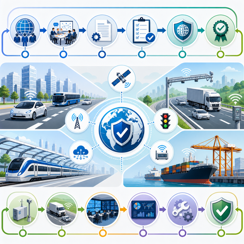
In an increasingly digital world, the ability to manage, communicate, and share precise location and speed information is critical for the modern transport industry. Intelligent Transport Systems (ITS) and telemetering are at the heart of smart mobility, enabling everything from safe navigation and efficient traffic management to real-time data aggregation. This article explores four cornerstone international standards—ISO 17572-4:2020, ISO 21219-17:2023, ISO/TR 12770:2023, and ISO/TS 21219-22:2017—that define global best practices for location referencing, traffic information, data aggregation, and telemetering in transport. By implementing these standards, businesses and authorities can unlock new productivity, increase security, and scale solutions across diverse cities and regions—foundational steps for embracing the connected and automated mobility revolution.
Overview / Introduction
Transport is evolving rapidly, driven by digital transformation, connected vehicles, and the demand for safer, smarter mobility solutions. Intelligent Transport Systems (ITS) harness advanced technologies and telemetering, transforming traditional traffic management, logistics, and commuter experiences.
Why do standards matter? From seamless data sharing to reliable lane-accurate navigation, standards ensure interoperability, security, and clarity across manufacturers, regions, and devices. As businesses implement new technologies, compliance with internationally recognized standards not only meets regulatory requirements but also creates opportunities for efficiency, competitive advantage, improved decision-making, and safer streets.
In this article, we unpack four key standards that underpin many transport innovations:
- ISO 17572-4:2020 — Precise relative location referencing
- ISO 21219-17:2023 — Speed information for travelers (TPEG2-SPI)
- ISO/TR 12770:2023 — ITS data aggregation role and model
- ISO/TS 21219-22:2017 — OpenLR location referencing (TPEG2-OLR)
Whether you are a city planner, ITS developer, regulator, or business leader, understanding these standards is essential for secure, scalable, and future-ready transport solutions.
Detailed Standards Coverage
ISO 17572-4:2020 - Delivering Lane-Accurate Location Referencing
Intelligent transport systems (ITS) — Location referencing for geographic databases — Part 4: Precise relative location references (precise relative profile)
Scope & Purpose: This standard sets out the Precise Relative Location Referencing Method (PRLRM), enabling systems to reference the exact lane or junction for transport-related objects within geographic databases. Unlike earlier standards that focus on broader positional data, ISO 17572-4:2020 supports highly granular referencing—crucial for connected vehicles, automated driving, and advanced traffic management.
Key requirements and specifications:
- Defines a conceptual data model for location referencing methods (LFMs), supporting interoperability across diverse systems.
- Supports two referencing methods: lane number counting (for locations within road segments) and displacement from a reference point (ideal for intersections and complex layouts).
- Encourages 3D positional information, not just 2D coordinates, allowing height (vertical) positioning.
- Clarifies how references should remain robust against map discrepancies caused by variations in database construction or environmental changes (like ground movement).
- Specifies message structure but leaves physical encoding to implementers, enhancing flexibility.
Who should comply: Commuter information providers, navigation system developers, municipalities, transport authorities, and suppliers of in-vehicle ITS applications who need lane-level accuracy or data exchange at precise locations.
Practical implications:
- Facilitates accurate mapping for advanced driver assistance systems (ADAS), automated vehicles, and dynamic routing.
- Enables interoperability across different proprietary map formats.
- Supports multi-vendor deployment and scalable smart city solutions.
Key highlights:
- Location referencing accurate to individual lanes and junctions
- 3D positional data capability (height-aware referencing)
- Methods for resilience against data/model discrepancies
Access the full standard:View ISO 17572-4:2020 on iTeh Standards
ISO 21219-17:2023 - Reliable Speed Information Broadcasting (TPEG2-SPI)
Intelligent transport systems — Traffic and travel information via transport protocol experts group, generation 2 (TPEG2) — Part 17: Speed information (TPEG2-SPI)
Scope & Purpose: This innovative standard defines the TPEG Speed Information (SPI) application. Its purpose is to offer accurate and timely speed limit data to drivers and in-vehicle systems, including variable and temporary limits that are not yet reflected in map databases. It thus fills a critical gap between static road signage and rapidly changing traffic regulations.
Key requirements and specifications:
- Supports both static and dynamic (temporary or variable) speed limits.
- Differentiates information by lane and vehicle type for greater precision.
- Standardizes compact encoding to minimize bandwidth in transmission—vital for wide-area broadcast and cellular services.
- Enables both direct (posted limits) and indirect (context-based or precedential) speed information.
- Interoperable with established TPEG2 transport and travel information protocols.
Who should comply: Automotive OEMs, navigation and driver assistance system providers, traffic message broadcasters, city/road authorities, app developers providing traffic and travel data.
Practical implications:
- Enhances safety by ensuring drivers always have up-to-date speed limit information regardless of changing traffic conditions.
- Supports deployment of automated and connected vehicles that depend on trusted speed data streams.
- Opens new possibilities for personalized routing and adaptive cruise control systems.
Key highlights:
- Accommodates static, dynamic, and event-based speed limits
- Lane- and vehicle-specific speed limit data
- Bandwidth-efficient protocol for real-time delivery
Access the full standard:View ISO 21219-17:2023 on iTeh Standards
ISO/TR 12770:2023 - The Backbone for Data Aggregation in Smart Mobility
Intelligent transport systems — Mobility integration — ITS data aggregation role and functional model
Scope & Purpose: With urbanization and smart city initiatives on the rise, the ability to aggregate, share, and manage ITS data efficiently and securely is fundamental. ISO/TR 12770:2023 presents a robust role and functional model for ITS data aggregation, covering how actors coordinate the intake and exchange of vast, multi-source transport datasets.
Key requirements and specifications:
- Defines a framework for ITS data aggregation, vital for cohesive smart city operations and cooperative ITS applications.
- Identifies privacy, security, and trustworthiness as essential design principles for any aggregation platform.
- Proposes open source and open API approaches to promote interoperability and scalability.
- Highlights the need for big data management, digital twin technologies, and integration with urban policy and planning.
- Describes the conceptual architecture connecting in-vehicle systems, application providers, aggregators, map services, and regulatory entities.
Who should comply: Smart city architects, ITS platform providers, city governments, transport service aggregators, app developers, privacy authorities, and OEMs integrating data from multiple sources.
Practical implications:
- Supports safe, secure, and trusted sharing of data across public and private stakeholders.
- Encourages scalable ecosystem design for mobility-as-a-service (MaaS), automated driving, and integrated transport management.
- Lays the groundwork for advanced analytics, urban planning, and regulatory compliance.
Key highlights:
- Role-based, actor-centric model for ITS data aggregation
- Emphasis on privacy, data security, and open interfaces
- Enables interoperability and big data analytics for smart city mobility
Access the full standard:View ISO/TR 12770:2023 on iTeh Standards
ISO/TS 21219-22:2017 - Map-Independent Location Referencing with OpenLR
Intelligent transport systems — Traffic and travel information (TTI) via transport protocol experts group, generation 2 (TPEG2) — Part 22: OpenLR location referencing (TPEG2-OLR)
Scope & Purpose: ISO/TS 21219-22:2017 brings greater flexibility to digital traffic and travel information, defining the OpenLR logical data format for map-agnostic location referencing. By dynamically generating location references—rather than relying on pre-coded identifiers—ITS systems can transmit traffic alerts, forecasts, or navigation cues without dependency on any specific map database.
Key requirements and specifications:
- Defines structures for encoding linear (road segments), point, and area locations for traffic information.
- Ensures location information can be generated and interpreted regardless of the underlying map provider—crucial for global interoperability.
- Establishes clear data format rules and logical components for message construction via TPEG-LRC (Location Referencing Container).
- Suits real-time transmission to in-vehicle systems, smartphones, and portable navigation devices (PNDs).
- Can be extended and integrated within broader TPEG2 applications suite.
Who should comply: Traffic information service providers, navigation service developers, automotive manufacturers, mobile application providers, transport authorities seeking scalable traffic alert dissemination.
Practical implications:
- Delivers location-based updates that are functional across diverse devices and platforms.
- Reduces time and cost compared to maintaining massive libraries of static location identifiers.
- Enables accurate, map-independent delivery of traffic messages—ideal for evolving navigation landscapes.
Key highlights:
- Map-independent dynamic location referencing
- Handshake-free, real-time traffic and mobility data
- Supports a variety of location types (linear, point, area)
Access the full standard:View ISO/TS 21219-22:2017 on iTeh Standards
Industry Impact & Compliance
Why Standards Are Critical in Transport Telemetering
In the fast-paced world of smart mobility and intelligent transport solutions, adhering to the latest international standards is not just a best practice—it’s a business necessity. These standards:
- Enable secure and reliable exchange of traffic and speed data between independent systems
- Remove barriers to interoperability between vehicles, infrastructure, and user devices
- Standardize data formats for scalability, making expansion to other cities or regions seamless
- Enhance security and privacy by enforcing consistent, rigorous requirements
- Facilitate rapid integration of new technologies such as automated driving, MaaS, and crowd-sourced data platforms
Benefits of adopting these standards include:
- Improved safety for commuters and fleet operators
- Optimized routing, reduced congestion, and better fuel efficiency
- Real-time adaptation to changing regulations or traffic conditions
- Compliance with both national and international regulatory mandates
- Future-proofing investment in ITS infrastructure
Risks of non-compliance can include:
- Incompatibility with other players, resulting in market isolation
- Security and privacy vulnerabilities
- High costs of reengineering for future upgrades
- Missed opportunities for funding, partnerships, or regulatory approval
Implementation Guidance
How to Implement ITS and Telemetering Standards Effectively
1. Assess Your Existing Systems:
- Conduct a gap analysis of current ITS infrastructure and telemetering practices.
- Identify where data formats, security, and workflows differ from standard requirements.
2. Plan for Interoperability:
- Select solutions and partners that support the relevant ISO standards for location referencing, speed information, and data aggregation.
- Ensure both in-vehicle and back-end applications can process standardized data formats.
3. Prioritize Security and Privacy:
- Adopt protocols and controls specified within these standards for privacy, access, and secure data sharing.
- Engage with your legal and compliance teams to ensure alignment with local and global regulations.
4. Leverage Open APIs and Modular Architectures:
- Reduce integration costs and support scalability by using modular IT architectures.
- Choose vendors that commit to open source and open API strategies, where possible.
5. Train Personnel and Inform Stakeholders:
- Prepare your teams on the 'why' and 'how' of international standards in transport telemetering.
- Host user awareness sessions and workshops for staff and digital partners.
6. Engage in Continuous Improvement:
- Monitor evolving standards and participate in industry forums.
- Regularly review implementation practices, gather feedback, and adapt as best practices evolve.
Resources and Support:
- Industry consortia, such as TISA and ISO/TC 204
- Implementation toolkits from standards bodies
- Consulting services and academic partnerships
- Access to standardized documents via platforms like iTeh Standards
Conclusion / Next Steps
As the transport sector digitizes, international standards like ISO 17572-4:2020, ISO 21219-17:2023, ISO/TR 12770:2023, and ISO/TS 21219-22:2017 are the anchors enabling secure, scalable, and interoperable ITS deployments. They empower organizations to harness the power of real-time data, precision navigation, cross-border mobility platforms, and future-ready smart city solutions.
Key takeaways:
- Adopt lane-precise and map-independent location referencing to enable next-generation automotive applications and smart infrastructure.
- Deliver dynamic, reliable speed and traffic information to drivers, fleets, and public agencies—with robust compliance and safety as core pillars.
- Build trusted, scalable data aggregation platforms as the digital backbone of urban mobility.
Recommendations:
- Review and align your ITS projects and procurement strategies with the latest international standards
- Stay informed about evolving guidelines and participate in global industry networks
- Use platforms such as iTeh Standards to access the full text, updates, and guidance for each standard
Drive your ITS innovation safely and smartly—leveraging proven international standards for every journey.
Categories
- Latest News
- New Arrivals
- Generalities
- Services and Management
- Natural Sciences
- Health Care
- Environment
- Metrology and Measurement
- Testing
- Mechanical Systems
- Fluid Systems
- Manufacturing
- Energy and Heat
- Electrical Engineering
- Electronics
- Telecommunications
- Information Technology
- Image Technology
- Precision Mechanics
- Road Vehicles
- Railway Engineering
- Shipbuilding
- Aircraft and Space
- Materials Handling
- Packaging
- Textile and Leather
- Clothing
- Agriculture
- Food technology
- Chemical Technology
- Mining and Minerals
- Petroleum
- Metallurgy
- Wood technology
- Glass and Ceramics
- Rubber and Plastics
- Paper Technology
- Paint Industries
- Construction
- Civil Engineering
- Military Engineering
- Entertainment